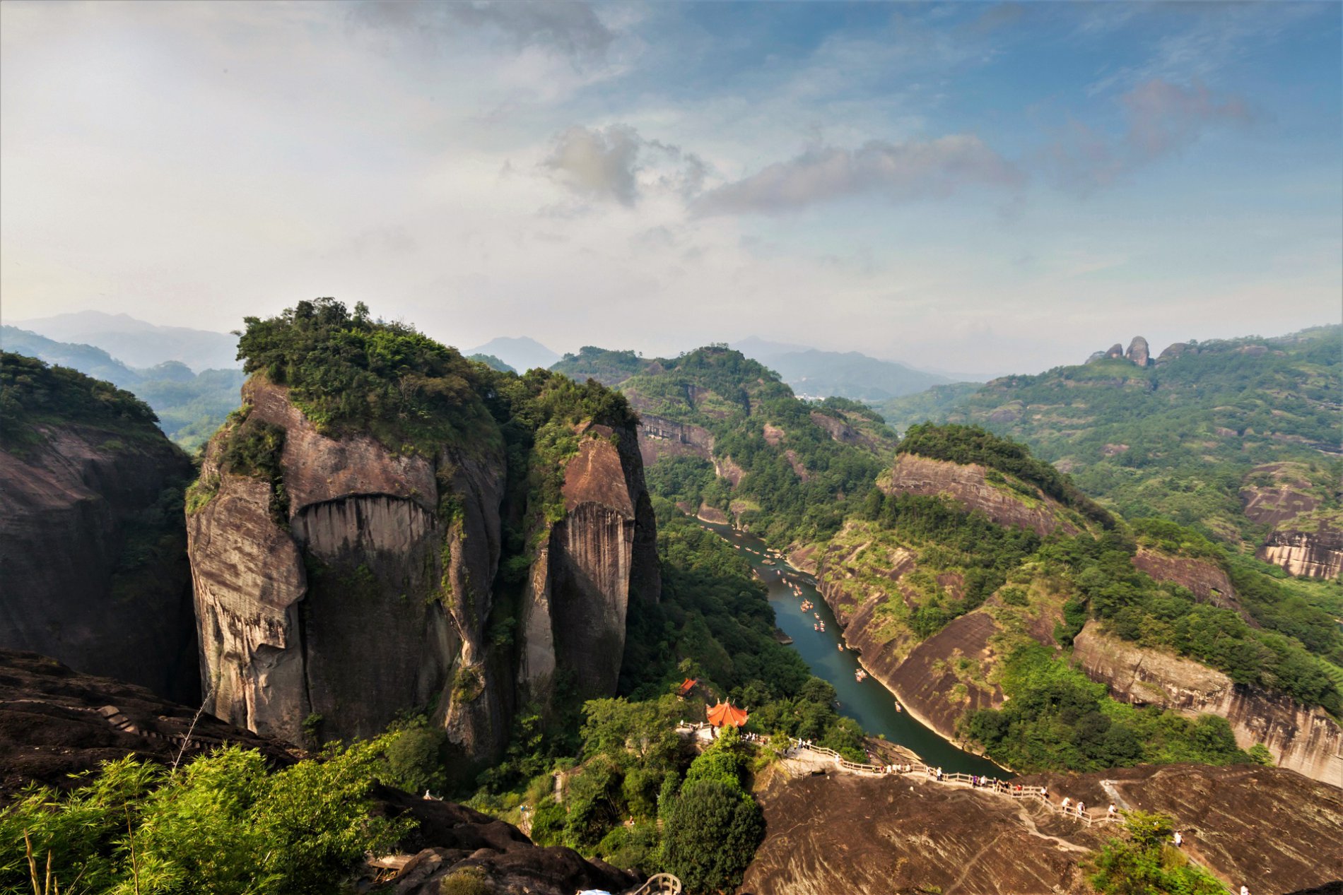
Straddling the border of Fujian and Jiangxi provinces, the Wuyi Mountain range includes the highest peak in southeast China. Every year, an estimated 8.5 million visitors enjoy the unrivaled forested sandstone landscape lining the turquoise river of Jiuqu (also known as Nine-Bend River). The region is also well-known for its tea and rich cultural heritage.
Today, the management of Wuyi Mountain is hindered by the presence of six different protected areas, each created by various government agencies and under fragmented management. In 2015, the area was selected as one of the pilot sites of China’s national park initiative. To support the pilot, the Paulson Institute, in partnership with the Heren Foundation, commissioned a research project to explore optimal spatial plans for the Wuyi Mountains Pilot National Park.
Open Full Project Details
The Wuyi Mountain’s humid climate with high rainfall affords it the lushness of mid subtropical evergreen forest. The region is a paradise for endemic wild plants and animals, such as the golden Kaiser-i-Hind (Teinopalpus aureus). However, urban development, reclamation of land for tea plantations, erosion of geologic features, and mass-tourism have imposed significant threats to the natural and cultural heritage. There is a need for a holistic spatial plan to ensure the long-term protection and efficient use of the Wuyi Mountain pilot national park.
The research team devised three potential spatial plans for the Wuyi Mountains pilot national park, giving special attention to the size, boundary, and zoning of the park. The research also conducted a cost-benefit analysis and compared different spatial plans of the national park to optimize the conservation goals in the region.
The findings informed the development of the master plan for Wuyishan pilot national park in 2017. The project provided an exemplary approach for other national parks in China on how to consolidate existing protected areas when developing spatial plans for national parks.
Open Full Project Details


